Modelling Hazards & Risk
Computational modelling and simulation are essential tools for understanding natural hazards, determining impacts, and assessing risk to people and places.
Bayesian Network
A Bayesian network is a probabilistic graphical model. Nodes represent the components and the links between their interactions. Each node has a conditional probability distribution associated with it, while the arrows represent a type of relationship between nodes.
The general approach of Bayesian Networks was found useful to combine various data streams with conceptual and indigenous understanding in volcanic hazard and risk assessment. We will extend the approach to model multiple volcanic hazards and provide dynamic decision support for island volcanic risks.
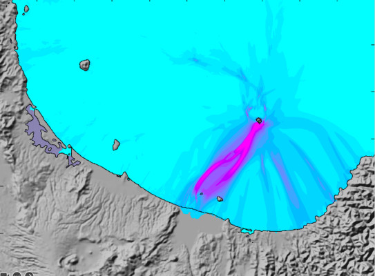
ASHFALL3D & HYSPLIT - ashfall modelling
Volcanic ashfall can be widespread and devastate on-land infrastructure. State-of-the-art codes, ASHFALL3D (developed by the USGS) and HySplit (Developed by NOAA/ARL), are used to simulate ash dispersal. These simulations of past and future eruptions will be calibrated using ash layers recorded in offshore sediment cores.
COMCOT - tsunami modelling code
COMCOT (Cornell Multi-grid Coupled Tsunami) is a computer-based simulation package for modelling tsunami generation, propagation, and land inundation effects. It is used by individuals and agencies for tsunami research and threat assessment and to inform infrastructure design and hazard mitigation planning.