Geology field sampling at Te Maari, Mt Tongariro
Researchers visited Te Maari crater on Mt. Tongariro to collect samples for the Beneath the Waves programme.
It might seem strange, to visit an inland volcano when our research is focused on off-shore island volcanoes. But the volcanoes in the Central North Island, running from Taranaki to Whakaari, beyond to the Kermadec Arc, and including Ruapehu and Tongariro/Ngauruhoe, are all cone volcanoes (also known as stratovolcanoes). Our learnings from these on-shore volcanoes, their activity and characteristics, can be transferred to Whakaari and Tūhua.
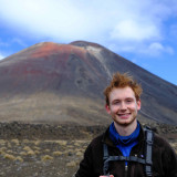
Massey University researchers Stuart Mead and Gabor Kereszturi, along with PhD students: Juliette Vicente, Dan Sturgess and Maia Kidd, recently undertook geology fieldwork at Te Maari. Te Maari Crater, on Mt Tongariro, is the most recent on-shore volcanic eruption to occur in Aotearoa. It erupted twice in 2012, for the first time since 1899. The activity ejected blocks kilometres away, minor ashfall occurred as well as a debris flow down a valley to the west.
The team collected different lithologies, which are individual units of rock sequences, used for mapping and correlation between areas. These units represent altered and unaltered rock were modified after the eruption(s) due to hot and acid hydrothermal fluid flow. The units are important to constrain the time required to alter volcanic rocks, reduce its strength and alter its rock permeability - characteristics that can potentially lead to phreatic eruptions and initiate volcanic landslides.
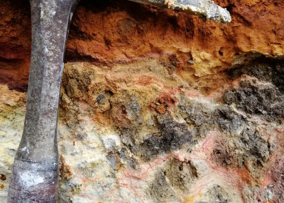
The geological samples are being examined with petrographic imaging and geochemical techniques. This will reveal their alteration mineralogy and help us to reconstruct the formation environment that is currently present on Tongariro, and other similar composite volcanoes, including Ruapehu and Whakaari.
Using a combination of laboratory strength testing and remote sensing, we are developing new methods using hyperspectral imaging for predicting basic rock physical and mechanical properties. This will inform numerical models to better locate potential zones that can generate volcanic landslides in the future, improving volcanic hazard assessment.
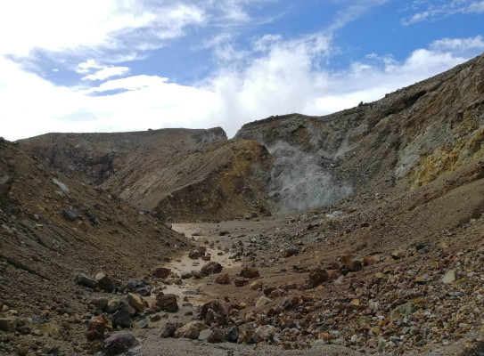
Header image: Newly formed fissure after the 2012 Te Maari eruption. White patches are hydrothermally altered rocks. [Photo: Gabor Kereszturi]